


SMA26 Survey System Ideal solution for survey
The SMA26 survey system is a survey system including Handheld; it integrates the advantages of high
precision, low power consumption, small size, convenient and fast portability and operation. It can meet
various engineering needs of surveying and mapping industries.
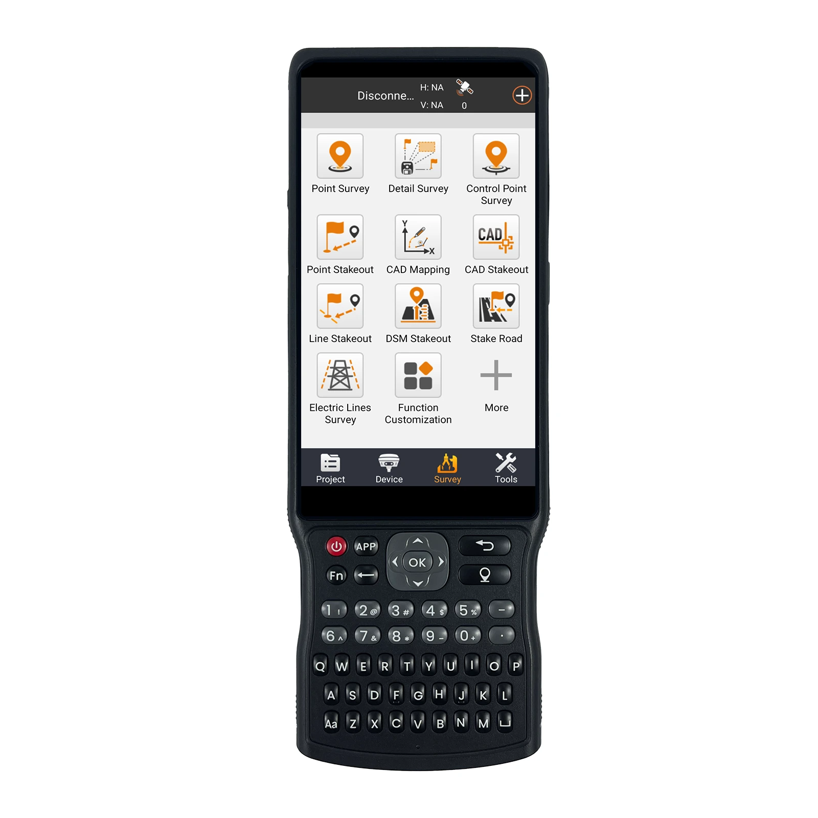
The system consists of two SMA26 GNSS receiver and a Handheld, Handheld with surveying software. The
software interface is clear, easy to learn and understand, convenient and practical, making work easier, faster
and more efficient. It can be widely used in surveying and mapping industries such as land, construction,
forestry, roads, electric power, water conservancy, oil pipelines, etc.
New 4G RTK
Plug in the SIM card and use it immediately. Dual mode integrated design, supporting direct connection to CORS real-time measurement or self built CORS benchmark station networking, efficient and accurate, and flexible adaptation to diverse surveying and mapping scenarios.
NEW LINUX OPERATING SYSTEM
Linux intelligent operating system, supporting voice playback, 4G, WEBUI, and WIFI connection. You can easily access and set up your device by opening a website and viewing its information. Experience hassle-free connectivity with our user-friendly interface. Advanced voice interaction capabilities and a convenient self-test function make device maintenance easy.
ALL-IN-ONE DESIGN
The device has built-in Bluetooth, radio, WIFI, storage, positioning, inertial navigation, and antenna modules. It can switch between base station mode and rover mode for automatic switching between the mobile and base station.
TILT COMPENSATION FOR HARD-TO-REACH MEASUREMENTS
The NebulasIV GNSS SoC integrates RF, baseband, and high-precision algorithms. It can track 40+ satellites for accurate positioning in complex environments. The built-in IMU module doesn't require calibration and achieves a 2.5cm tilt measurement accuracy (≤30°) with simple initialization.
5.0
design customization
Please fill out the form below to request a quote or to request more information about us. Please be sure to upload customized requirement documents or pictures, and we will get back to you as soon as possible with a response. we're ready to start working on your new project, contact us now to get started.
Please fill out the form below to request a quote or to request more information about us. please be as detailed as possible in your message, and we will get back to you as soon as possible with a response. we're ready to start working on your new project, contact us now to get started.
{{item.score}} Stars
{{item.pre}}%
{{item.nickname ? (item.nickname.slice(0, 2) + '*****') : item.source === 1 ? 'mall buyer' : '--'}}
{{item.comment_time}}
Review in the {{item.country}}
{{itemAttr.params_key}}: {{itemAttr.params_value}}
Get in touch with us
Just leave your email or phone number in the contact form so we can send you a free quote for our wide range of product!
Related Products
We are a professional pos terminal manufacturer and high-tech company registered in Shenzhen and Hong Kong, China, focusing on EFT-POS terminal R&D.
Tel: 86-755-86276295
Email: sales@szfptech.com
Address: Room 213, Building 1, Mingliang Science Park, 88 Zhuguang North Road, Taoyuan Street, Shenzhen, Guangdong, China
Copyright © 2026 SZFP | Privacy Policy Sitemap